Post-lineage fire:
What we know
We are coordinating with partners to deliver resources and guidance to keep you and your family safe. You can find guidance at the link below.
Sign up for our mailing list to be notified as new information becomes available.
affected by the 2025 LA fires?
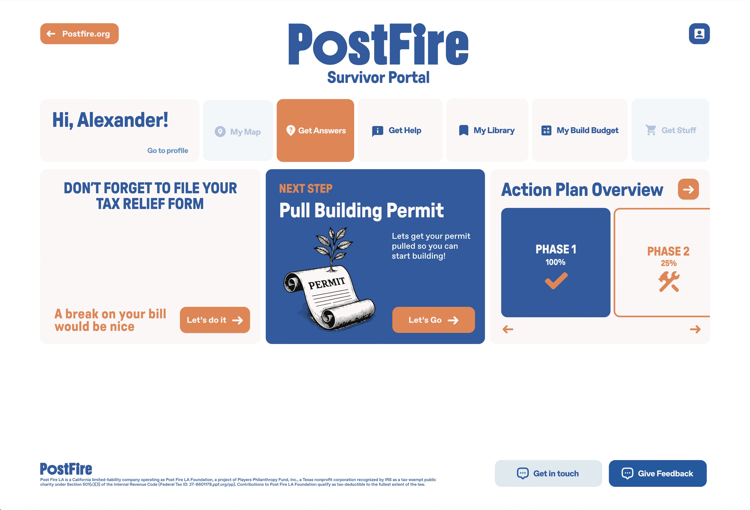
We’ll build you a customized Action Plan, tailored to your circumstances, for free.
The PostFire Portal walks you through every step of recovery with expert guidance - from insurance to finances, remediation, construction, and more.